Original Survey Maps
Early in the State of Michigan’s history, the government sent out surveyors to chart and map each and every corner of their new state. The survey maps of the Upper Peninsula were prepared throughout the 1840s to the 1850s.
Surveyors tramped through woods and swamp with their chains and compasses and transits. They cut up our state into thousands of “township squares” or “survey townships.”
Every township square is six miles by six mile each and has its own unique designation, written something like this T 46N R 32W, or Township 46 North Range 32 West. Each square is further cut into 36 smaller squares, numbered one through 36. Each smaller square is chopped into four quarters and can be further subdivided. These designations are often used on deeds, or other legal documents, in order to precisely determine a landowner’s boundaries. You see these descriptions in deeds and other legal documents all the time.
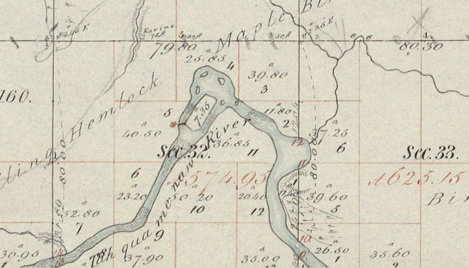
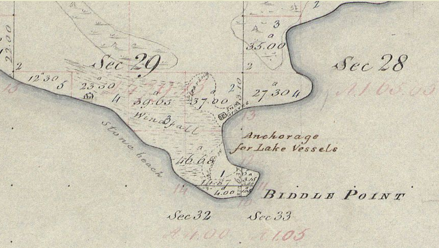
But the original surveyors of Michigan did much more than chop up the state into thousands of perfectly square chunks. They took note of what they saw around them. Their maps are treasure troves of interesting information, swamps, sloughs, marsh, types of trees, types of soil, types of rocks, trails and roads (if any), railroads, lakes, rivers, creeks, harbors, beaver dams, beaches, names of major landmarks. They even show the odd building or Native American fishing settlement.
There are several ways to view these maps online. Michiganology.org has them all, but their search bar, frankly is not very good yet and there are easier ways.
In order to use them effectively, you will need to know the Township and Range numbers of the piece of land you are most interested in.
If you don’t know exactly which Township Square you want, then I would go to the State of Michigan website and look at their section of General Land Office Plats. https://www.michigan.gov/som/0,4669,7-192-78943_78944_78955-31058–,00.html
They have a nifty little map feature that lets you narrow down until you have the right designation. For instance, if I was looking for Betsy Lake, I would keep clicking until I found it. First Luce County, then the “north part” and then I’ve found Betsy Lake. It is actually in (mostly) the Southeast Quarter of Township 49 North 8 West.

The plat images on the State of Michigan website are black and white copies of the originals, and their quality, while adequate, is not the best. Words are not always legible. These copies also sometimes have modern annotations (i.e., names of lakes) written on them that the originals lack. Note that Betsy Lake and Clark Lake are clearly identified here.

If you are interested in the actual originals, once you have your Township info, I’d go instead to https://glorecords.blm.gov/ (the Bureau of Land Management, General Land Office) and click Survey Plats. Then enter in your state, your modern-day county, and township numbers, then click “Search Surveys.” Like this:

Then you click the button “Original Surveys” and then the button “Plat Image” and then take a gander their high quality scans of the original surveys.

The lakes are not named here, but they are in color, and the lettering is far easier to read. Here it is shown that what will eventually become Betsy Lake is surrounded by (Tamarack) and Spruce Swamps.
Let’s look at a few more examples. Here’s what would one day become Curtis:

Here’s Upper Tahquamenon Falls, showing a “portage trail”:

And the Lower Falls…

Whitefish Point Lighthouse, which was brand-new at the time:

Naubinway (including a section noted “ind. Graves” and a building toward the west):

Have fun!